Shanghai tram map
You can find on this page the Shanghai tram map to print and to download in PDF. The Shanghai trams map presents the network, zones, stations and different lines of the tramway of Shanghai in China.
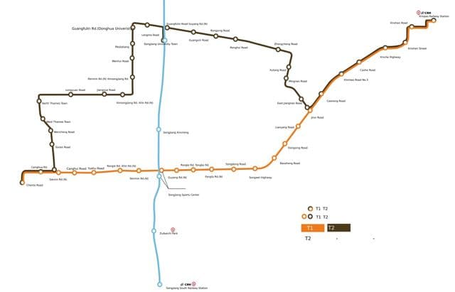
Shanghai tramway map
The Shanghai tram map shows all the stations and lines of the Shanghai tramways. This tramway map of Shanghai will allow you to easily plan your routes in the trams of Shanghai in China. The Shanghai tram map is downloadable in PDF, printable and free.
Zhangjiang Tramway is a tramway line undergoing construction in Shanghai, it adopts the Translohr, one type of Guided Bus manufactured by Lohr Industrie. It planned open at December 2008, but as the brochure of Lohr, it now will open on July 1st 2009. The whole plan of Zhangjiang Tramway is running from Zhangjiang Hi-Tech Park Station of Shanghai Metro Line 2 to Heqing Town as you can see in Shanghai tramway map.