Shanghai streets map
You can find on this page the Shanghai streets map to print and to download in PDF. The Shanghai roads map presents the road network, main roads, routes and motorways of Shanghai in China.
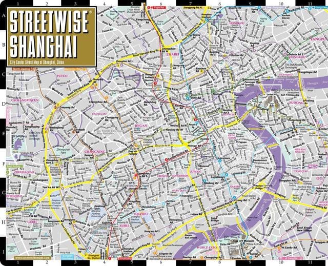
Shanghai streets map
The Shanghai streets map shows all street network and main roads of Shanghai. This streets map of Shanghai will allow you to find your routes through the streets of Shanghai in China. The Shanghai streets map is downloadable in PDF, printable and free.
Experience the best of Shanghai on foot or bike. There are the cozy streets of the former French Concession, the shopping streets around the Bund, the bike friendly streets along Suzhou Creek, and more as its mentioned in Shanghai streets map. While Shanghai has many must see tourist attractions in its streets. Taikang street is an alley that runs through Tianzifang, a renovated neighborhood that houses boutique restaurants and shops. Wukang street, also known as Ferguson Lane, is an extremely expat-friendly street in the former French Concession.
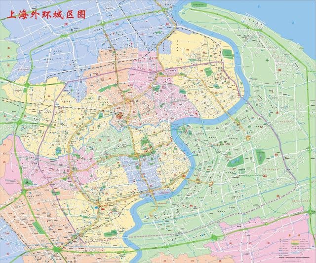
Shanghai roads map
The Shanghai roads map shows all road network and highways of Shanghai. This roads map of Shanghai will allow you to find your routes through the roads and motorways of Shanghai in China. The Shanghai roads map is downloadable in PDF, printable and free.
Shanghai is a major hub of China road network. Many national roads (prefixed with G) pass through or terminate in Shanghai, including G2 Beijing–Shanghai road (overlapping G42 Shanghai–Chengdu), G15 Shenyang–Haikou, G40 Shanghai–Xi’an, G50 Shanghai–Chongqing, G60 Shanghai–Kunming (overlapping G92 Shanghai–Ningbo), and G1501 Shanghai Ring road as its mentioned in Shanghai roads map.