Shanghai topographic map
You can find on this page the Shanghai topographic map to print and to download in PDF. The Shanghai elevation map present the topography, river and relief of Shanghai in China.
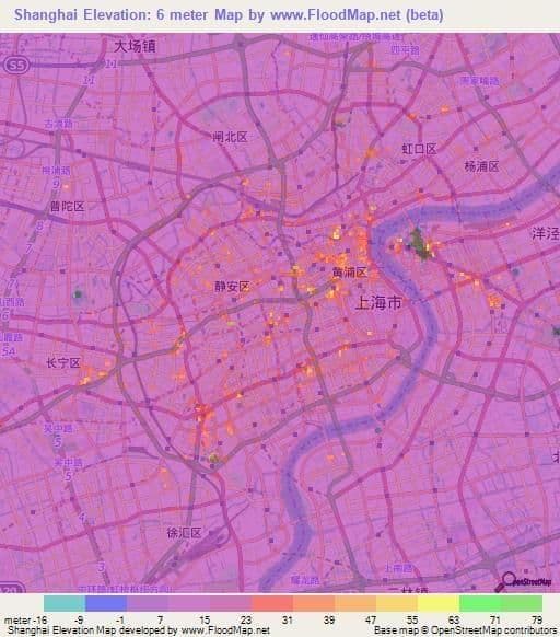
Shanghai elevation map
The Shanghai topographic map shows elevation, hills and landforms in Shanghai. This elevation map of Shanghai will allow you to know topography, river and relief of Shanghai in China. The Shanghai topographic map is downloadable in PDF, printable and free.
The vast majority of Shanghai 6,340.5 km2 (2,448.1 sq mi) land area is flat, apart from a few hills in the southwest corner, with an average elevation of 4 m (13 ft) as you can see in Shanghai elevation map. The city location on the flat alluvial plain has meant that new skyscrapers must be built with deep concrete piles to stop them from sinking into the soft ground. The highest elevation point of Shanghai is at the peak of Dajinshan Island at 103 m (338 ft).