Shanghai bus system map
You can find on this page the Shanghai buses map to print and to download in PDF. The Shanghai bus system map and the Shanghai trolley map present the network, stations and lines of the buses and trolley of Shanghai in China.
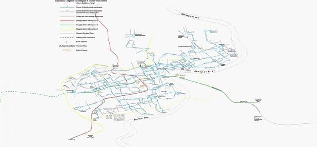
Shanghai trolley map
The Shanghai trolley map shows all the stations and lines of the Shanghai trolleybus system. This trolley map of Shanghai will allow you to easily plan your routes in the trolleys of Shanghai in China. The Shanghai trolley system map is downloadable in PDF, printable and free.
Shanghai iconic trolley buses have long been joked about by locals who often refer to them as the “braids” of the city (see Shanghai trolley map). But the electric-powered transport system looked until recently as though it was going to be faded out, like many other aspects of city life. The oldest trolley route, the No. 14, was shut down in June 2014.